A Guide to the Outdoors for Mums
At Amble, we believe the outdoors is for everyone, but we also know that our relationship with it shifts and changes through different seasons of life. Motherhood can be one of the biggest. Whether you're...
Keen for a hike but not sure where to go? It can be tricky to find spots to explore, especially if you don’t have a car and want to get outdoors.
What hikes can you catch a train to? Or how can you find a lookout that’s accessible via bus in Melbourne?
We’ve done the hard work for you and have put together a list of top hikes in Melbourne that are accessible via public transport/PTV.
So if you’re sick of walking around your local park and are in need of outdoorsy inspo, keep reading and bookmark this list for later.
From Brighton to Beaumaris, this 17km hike takes approx 2 hours and you can get there by taking the train to Middle Brighton station. It has some great ocean views and will take you through Bayside’s indigenous, historical, artistic and environmental heritage along the way.
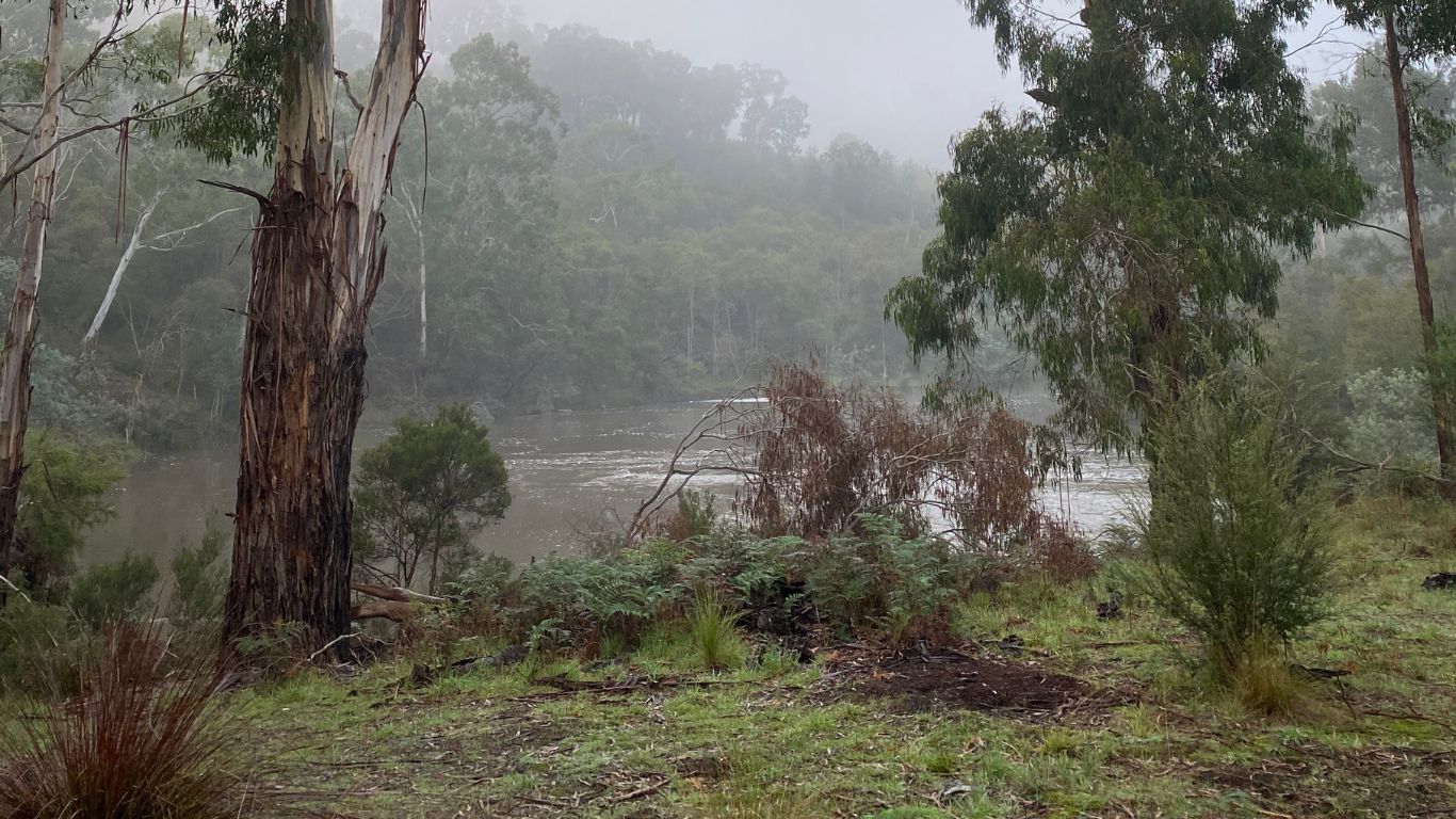
This popular 9.5km hike loops around Yarra Bend Park, Studley Park and Dights Falls and takes approx 2 hours. You can either catch the train to Victoria Park station or take the 202 bus towards Yarra Bend Park.
Take a scenic route around Albert Park Lake which stretches 5km. This walk is on the shorter side, taking 1 hour and staying flat the whole time. If you want to enjoy views of the lake with ducks and greenery, this one’s for you. Located in the heart of Albert Park, you can reach it on trams number 1, 3, 3a, 5, 6, 12, 16, 64, 67 or 96 (note that some of these trams will end up at a different part around the lake).
From Fitzroy North to Fawkner, this hike along the Merri Creek Trail is 15.8km long and takes approx 3 hours and 20 minutes. A point to point route with many reserves and parks, you can get to the starting point by training to Merri station or taking tram 11 towards West Preston.
Right near Mount Dandenong, the Dandenong Ranges Loop is an 11.9km trail which, generally considered a moderately challenging route, takes approx 3.5 hours to complete. Great for bird lovers, lots of birdlife can be found from fairy wrens to kookaburras. You can also add a quick extra stop at the end to see Olinda Falls. There are two main ways to get there on PTV; train to Belgrave station then catch the 694 bus to Mt Dandenong, or train to Croydon station (Lilydale line) and catch the 688 bus towards Upper Ferntree Gully.
Located in Organ Pipes National Park, this hike is 3km long and takes around 1.25 hours to complete. The best part is the Organ Pipes themselves which formed roughly 1 million years ago from molten lava that solidified into basalt. To get there, first train to Sunbury, Diggers’ Rest or Essendon station. Then take the 483 bus towards Moonee Ponds where you can get off right at the park (stop Organ Pipes National Park/Calder Fwy).
Plenty Gorge park extends along the Plenty River and you can go for a 21km hike through the gorge which takes 5 hours. Simply train to South Morang or Middle Gorge station on the Mernda line and expect to encounter some kangaroos, listen to lots of birdsong and check out Carome Falls.
P.S. This longer hike pairs well with lightweight, breathable apparel like our Terra Pants.
Follow along the historical railway and enjoy scenic views of the Yarra Ranges National Park over 2 days on this 40km hike. To get there you can train straight to Lilydale station and the trail begins just behind it.
There are so many wonderful hiking trails out in the Dandenong Ranges but one of the most popular is the loop trail near Kallista; Sherbrooke Falls via Ridge, Moores Break and Lloyds Track. It takes approx 2 hours; full of fern trees, shade and a waterfall, this one is sure to not disappoint. The best way to get there using PTV is by taking the train to Belgrave station, then catching the 694 bus.
P.S. Want a waterproof layer that packs light? Check out our Refuge Jacket - perfect for a day in the Dandenongs.
If you want to head to The Great Ocean Road then Lorne has heaps of great hiking trails to offer. These are just some of the most popular ones which are of course accessible by PTV.
A 7.7km loop trail which takes approx 2 hours and 22 minutes, this hike packs a punch passing by 3 waterfalls and following 2 creeks most of the way. To get there on public transport you’ll need to train to Geelong Station on the V-line (boards from Southern Cross Station). Next take a V-line bus from the station towards Warrnambool and get off at the Lorne Hotel & Great Ocean Road stop. This drops you in the middle of town and you can then walk approx half an hour along Allenvale road to reach the starting point.
Following the Erskine River for 15.1kms, this out-and-back hike takes 4 hours and 19 mins. You can get to Lorne the same way as previously mentioned but get off the bus at Lorne Visitor Centre & Great Ocean road stop as it’s closer to where you’ll start walking.
On the other side of the coast, French Island is just off the Mornington Peninsula and has an easy, enjoyable 18.3km loop trail which takes approx 3 hours and 43 minutes to complete.
To get there you’ll need to firstly train to Frankston station and then switch trains to get to Stony Point station. From there the island is accessible by ferry for a small cost.
There’s been some wild weather lately, so before you go, make sure you check out Parks Victoria website to check that the park you’re visiting is open, as some sections might be closed temporarily.
Remember to always bring sunscreen, water, a waterproof jacket (in case it’s windy or rainy) and tell a friend where you’re heading.
And if your next step is figuring out what to wear then we’ve got you covered, with our Waterproof Jackets.
Happy hiking and don’t forget your myki too!

